|
The Geoglyph of Northern Chile
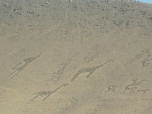
These were made by ancient communities and they are dated back from 1000 to 1400 BC. This is the period of the Regional Development when the land was divided into multiple communities and there was a strong sense of cultural and social exchange. It’s believed that they are drawn or painted on the slopes of some hills to show the path from the sierra towards the coast. But it’s also believed they were used for ritual purposes. They had two drawing techniques. In one of them they would use the rocky dark coloured material to paint and ended up as a dark painting and with a lighter backround. The second method they would scrape the superficial oxidated surface and this would result in a light coloured picture with a dark backround. These pictures are classified into three groups: There are many of these seen here in Chile. They are found from Arica to the Loa River. These are their locations from North to south.
|